
59.7 miles, 187' Elev Gain, 4% max grade, 13.4 mph Avg (click for route map)
Another early start, since our longest ride day lay ahead. The hotel breakfast was lacking the heartiness of a good old English fry up, and it appeared some other hungry guests had wiped out most of the cheeses and meats on offer, c'est la vie!. Unlike Day 2 through Kent, the landscape was going to be as flat as a pancake (note only 187' of elevation gain!), but the weather outside looked to be a little damper and heavily overcast.
We were all ready to roll close to 8am, we were starting to get more efficient at packing the Apidura bags, and attaching them to the bikes!. A light mist was in the air, and a breeze began to kick up, it was looking like a rain jacket and helmet cover type of day.
Immediately after setting off, a light drizzle set in, this would be with us all day, off and on, with about a 50f (10c) temperature. The going was easy though, it almost felt like sitting and spinning in your lowest gear, quite the contrast from the Kent hills. We reached the first French town at mile marker 13 in under an hour, this is the pretty walled town of Bergues and was worth a 10 minute stop to take some snaps.
 |
| Clo Posing for a pic |
 |
| Walled town of Bergues |
Much of the route to Bruges I had mapped out to follow alongside canals, which are plentiful in this region of NE France and Flanders. Most of the roads along the route were very narrow, often it was hard to tell if in fact they were a road or a just a cycle path; we were reminded a few times though that they were actually roads when we encountered a car or a tractor at an inopportune moment!.
At mile marker 20.7 we reached the French/Belgium border, the border was so subdued we even pondered for a while whether it actually was the border or not - the signs in Flemish though convinced us it was.
 |
| French/Belgium border |
The rain was getting a little heavier now, and we were all a little cold(er), a strong cup of coffee was sounding good. The town of Veurne was only another 8 miles from the border, and at mile marker 28 (half way), this had been my planned lunch stop. We rolled into the central square right before 11am, and got our first taste of wet slippery cobblestones, not the type of riding for the faint of heart!. Our mission was to find coffee, which at first was not an easy task, the only place that appeared to be open was a little restaurant in the square called "Brasserie Flandria", this turned out to be a little gem of a place!.
 |
| Brasserie Flandria |
We piled all the bikes into their small outdoor eating area, and took over almost all of the restaurant (it was a small place), everyone ordered coffee, and boy did it taste good!. Since the rain was still falling, and the warmth of this little restaurant was too comforting, most of us ordered lunch too, the Panini were excellent, as was the service.
It was hard to drag ourselves from the warmth and face the wet, cold and windy weather again, but it seemed like the rain had eased a bit at least. Most of the route after Veurne followed pretty canals using cycle route LF1, and the Belgium Cycle node network. The only other town before Bruges was Nieuwpoort, a mere 6 miles from Veurne. Nieuwpoort was the northern most town on the WW1 frontline, the Belgian army flooded the fields in 1914 and held the Germans back until 1918. The town itself was heavily damaged in WW2 too, so is not as picture postcard as Veurne.
 |
| WW1 King Albert Memorial, Nieuwpoort |
At mile marker 49 route LF1 headed NE, and the Kanaal Nieuwpoort-Plassendale joined the Kanaal Gent-Oostende, at this junction we headed east towards Bruges following the canal path for 9 miles. This stretch of canal is beautiful, wide and tree lined, unfortunately we did not stop much to enjoy it though, since we were wet and cold, and just wanted to get to the hotel. The final 1 mile through Bruges was on side streets with wet cobblestones (note: in most of the Belgian towns, it is not cars you need to worry about, but other cyclists, bicycles are the primary mode of transport, and they own the road, or so it seems). We finally reached the awe inspiring Place de Bruges at mile marker 59, the smiles were wide and it was clear the weather had not dampened anyone's spirits, the sun even started to poke out!.
Check in was generally a quick process at Martin's Bruges, we locked up the bikes in the underground car park. and decided to meet in the lobby at 5.30 pm after showering. I have been to Bruges several times, and knew a visit to the only brewery in the old town was a must, except they closed at 6 pm!. All but 1 of us hoofed our way across town, and made it with 15 minutes until closing - boy did that first beer taste good!.
 |
| Brugse Zot at De Halve Maan |
 |
| Brouwerij De Halve Maan |
We meandered our way back to the centre of town through a church courtyard, past the old harbour, and the food market, all the while looking for restaurant options. The choices for eating are endless, but it is almost potluck unless you do some research, or know where the locals eat. We ended up at a fork in a canal, and "De Torre" restaurant over looking the canal, it was not particularly busy, which I suppose should of been a clue. The food was expensive for what it was, mediocre at best, but filled a hole. (Tip: remember that you pay for water unless you ask for "tap" water).
The evening had now turned into glorious clear skies, and most of the day time tourists had left, it was a perfect time to wander, and grab a late night beer overlooking the Place de Bruges.
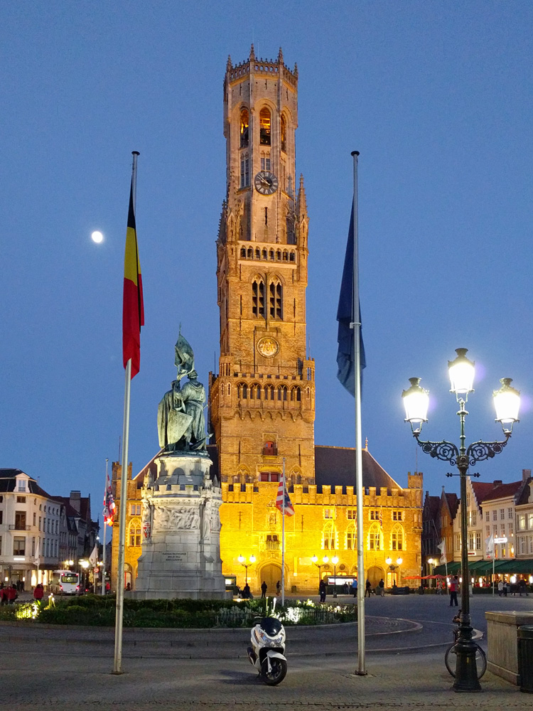 |
| Bruges is much quieter at night |

No comments:
Post a Comment